P6 hiking route "Palūšė - Ginučiai"

P6 hiking route "Palūšė - Ginučiai"

Download
Way of traveling: Route distance: 16 km Duration of the route: 5 h.

A challenging one-day hiking route starting in Palūšė, and ending in Ginučiai.

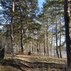
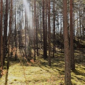
The route mostly made up forest roads, paths, and gravel roads.

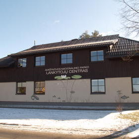
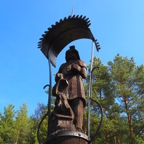
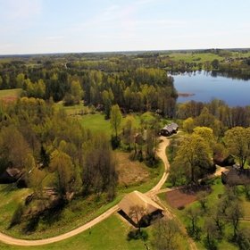
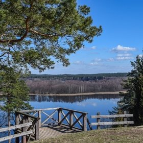
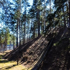
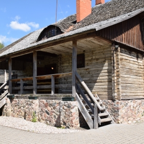
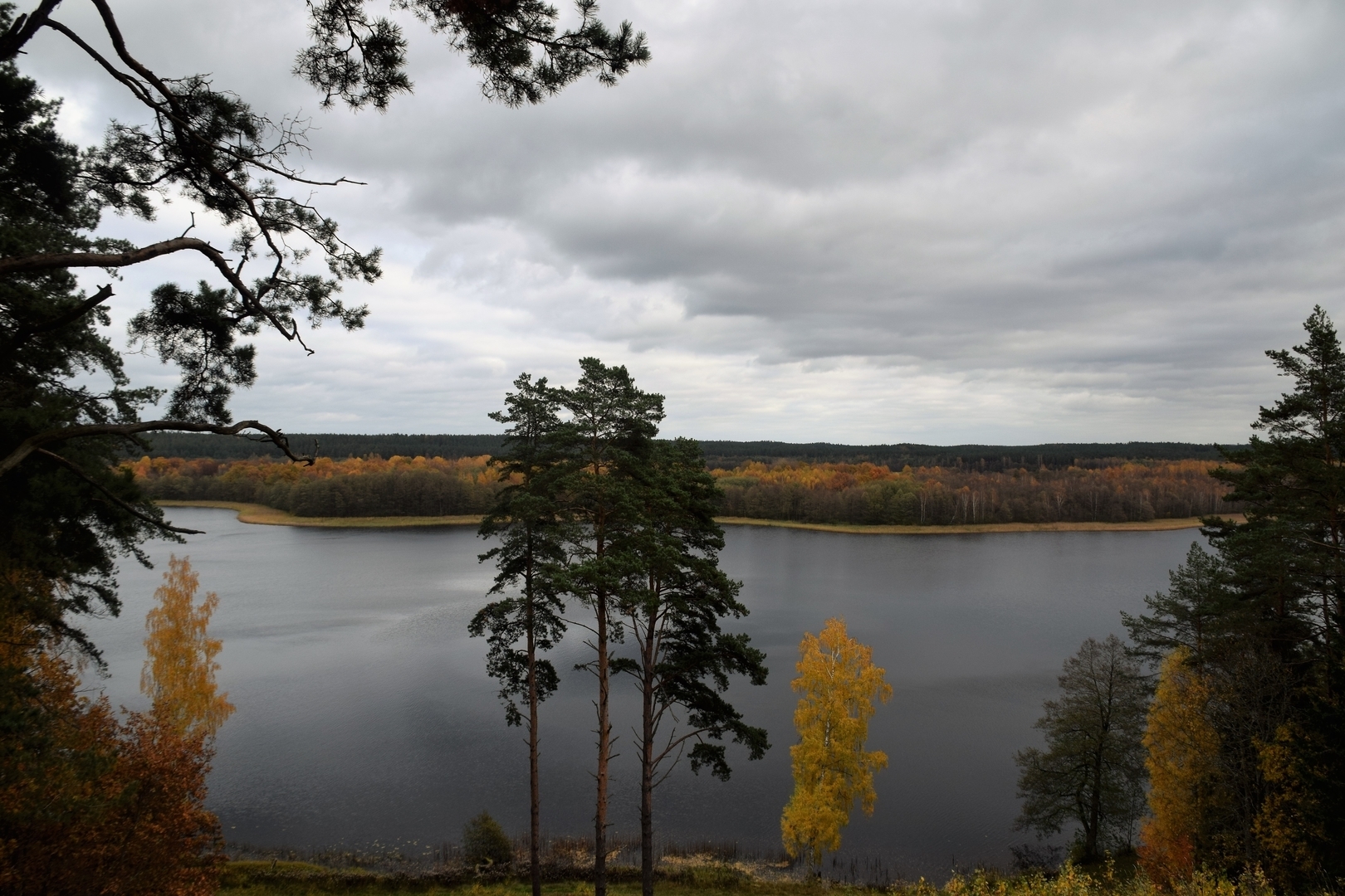
The route starts at Aukštaitija National Park Visitor Centre. Go right from the parking lot in the direction of Ignalina. After 400 m, you will see Palūšė beach on your left. Go towards the forest. Turn left after crossing the bridge and proceed along the lakeshore towards Meironys. On your way, you can look over wooden sculptures. After reaching the asphalted road, go along it passing the village of Meironys. At the end of the village, asphalted road ends and the gravel road starts. After 200 m from the end of the asphalted road, you will see a byway on the left towards Meironys campsite. After walking straight for 1.2 km, you will see a resting place by Asalnai Lake on your left. After another 500 m from the resting place you will see a sign directing towards Asalnai Pine. After walking another 1.2 km from this sign, turn left at the crossroad. From this point, approximately 1.3 km is left to Puziniškis. After coming out of the forest you will find yourself at the glade where Puziniškis village is located. At the very end of the street, there is an oak growing on a slope. From this oak, come back to the crossroad at the approaches to the villages and turn left to the road leading to north. Keep left at the road forks after 200 m. The road leads across the outskirts of the field, and makes a sharp right turn to the forest after 400 m. After 1 km, you will approach Puziniškis Mound on your right. Nearby, there is a resting place. From this resting place, you will see a bridge, after crossing the bridge, keep left, and after 1 km you will approach the village of Salos. Keep right in the three-road crossroad, and go towards the village of Salos II. Go in the direction of Salos II without turning from the main gravel road. You will reach the village after 1 km. At the approaches of the village Salos II, turn right after passing a barn on your right. Go along the path up to the forest and further until you reach a T-junction. Turn left. Go along the lake shore of Linkmenas lake until you reach the channel that connects the lakes of Alksnaitis and Linkmenas. There is a small bridge set up over the channel for pedestrians and cyclists. There is a pedestrian-bicycle trail going from the bridge to the top of Ladakalnis. Turn left at the first road fork, and turn right up the hill at the second one. The rise is rather steep. At Ladakalnis starts a gravel road that leads to Ginučiai Mound. Climb down the wooden stairs to the parking lot of Ginučiai, Papiliakalnė Mound. Keep left after reaching the asphalted road. Go along the road towards Ginučiai village. After coming to the village, you will come to a T-junction. Turn right and go along the main street of the village. You will approach a watermill after 600 m. If you want to reach the campsite of Almajo lake, go back 200 m from the mill. Turn right at the first three-way crossroad. At this point, you will move from asphalt road to the gravel road. Beside the last residential buildings you will arrive at a crossroad, where you should keep left. Walking along the Almajas lakeside you will arrive at a campsite. Here you can take a break, or stay overnight.

Route start. Exposition of the Visitor Centre in Palūšė
Temporarily closed for renovation!    The main topic of the display is "People of the Lakes". It presents ancient, as well as modern ways of fishing, rafting and swimming cattle to pastures. The display is oriented towards visitors of various ages and interests. It will help you to plan your own route around the park. While parents are busy with planning, kids can practice catching fish or "making" signal fire. Visitors Center Working Time: May and September - from Monday to Saturday from 9 am to 5 pm.; June-August - from Monday to Saturday from 9 am to 6 pm and...
Duration: < 1 min.
View
Duration: < 10 min. Distance: 1 km
The wooden sculptures ensemble
 There are 14 wooden sculptures standing on the shore of lake Lūšiai near Meironys village. In 1977, a group of folk artists carved these sculptures to perpetuated the natural beauty and legends of the Ignalina region. A few sculptures represent devils. Elder people say that even now, one of the devils lives in the nearby lake of Tarama.
Duration: 1 h.
View
Duration: < 10 min. Distance: 4.3 km
Asalnai pine
 The magnificent pine that grows on the shore of Lake Asalnai greets the travelers with its wide trunk and beautiful twisting. Scots Pine (Pinus silvestris). Trunk girth - 3.7 m. Height - 20 m. Age - approximately 320 years.
Duration: 1 h.
View
Duration: < 10 min. Distance: 3.9 km
Puziniškis mound
 Puziniškis mound is located in Linkmenys forest, near a strait between Linkmenas and Asalnykštis lakes. The mound is surrounded by a ditch and a rampart. This mound was used in the 1st millennium AD.
Duration: 1 h.
View
Duration: < 10 min. Distance: 2.3 km
Ethnographic villages: Salos II
 There are two villages called Salos. Both of them are located in a somewhat peninsula between Asalnykštis, Linkmenas, Alksnas and Alksnaitis lakes. The only way to reach this peninsula is from Antalksnė. According to written sources, a large family (the Kudabos) used to live by the border of Salos II. And even now people with the same last name live here. The village is known for its unique architecture and layout, as well as the established Salos cultural reserve. Unfortunately, only a barn and a cottage has remained since the 19th century; the other buildings were built in the 20th century. You can reach Salos II on foot...
Duration: 10 min.
View
Duration: < 10 min. Distance: 1.7 km
Ladakalnis
 The legendary Ladakalnis is the most famous sight of Aukštaitija National Park. The hill stands at 176 meters above sea level and is part of the Šilinškės Ridge. From Ladakalnis a wonderful panorama of 6 lakes can be seen. It is believed that this hill served as a place for pagan sacrifices to the Baltic goddess Lada - the great Mother. Ladakalnis is declared a geomorphological monument of nature.
Duration: 25 min.
View
Duration: < 10 min. Distance: 930 m
Ginučiai and Papiliakalnė mounds
 This 9-12th century archaeological monument was used for defence purposes in the first millennium AD. The mound complex is located in the middle section of the massive Šiliniškės Ridge. The famous Linkmenys castle, which was mentioned in the Livonia Chronicles by H.Vartberge  in 1373, stood here during the 13-15th centuries. Supposedly, the castle was ruled by Mindaugas' nephew in the 13th century. There is a stone at the top, on which there is mention of Lithuanian president Antanas Smetona’s visit here in 1934.
Duration: 30 min.
View
Duration: < 10 min. Distance: 1.7 km
Ginučiai Watermill
 Ginučiai watermill is protected as the nineteenth century technical monument. In the northern part of the building is the Museum exposition, and the southern part has double-guest rooms with modern amenities. They can accommodate up to 8 people. Double room costs € 50 per night.  In the cozy kitchen you can prepare your own meals or have lunch at the cafes during the summer. The mill is equipped with a sauna, where you can relax and cool down under the waterfall. 
Duration: 15 min.
View