Notice! There is no junction between the lakes Dringis and Baluošas, therefore water vehicles need to be transported by road for approximately 1.5 km.
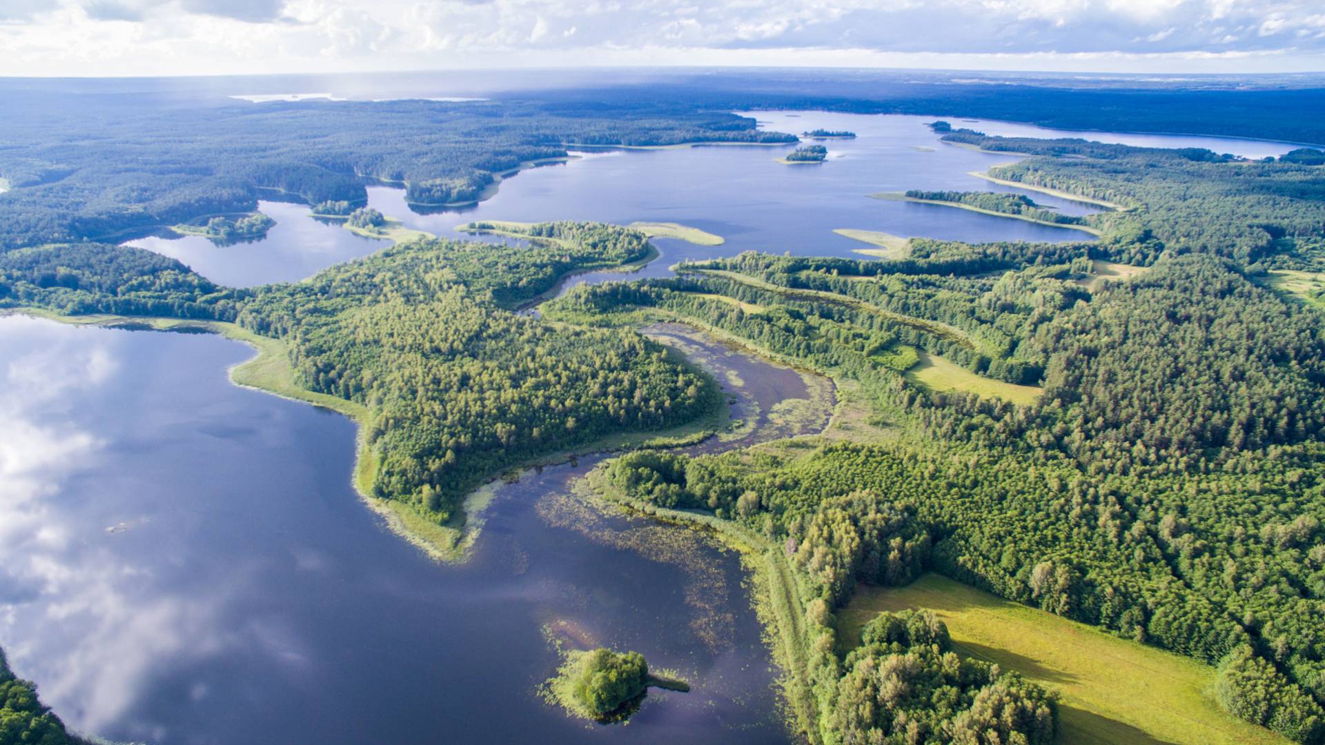
PalĹ«šÄ—-VaišniĹ«nai After leaving the Paluse Boat House, keep right, towards the northern Lüšiai lake shore. While going along the coast, you will be able to see the wooden sculptures set out along the path leading to Meironys. After approximately 2 km, you will see the village of Meironys on the northern coast. Continue towards the village to the channel connecting the two lakes. After entering the channel, go along Metronys village Before the end of the village, you will paddle up to a river that flows through the village. Go into this river After several hundreds of metres you will enter Dringykštis lake. Turn left at the island and paddle along the river in the northern direction. After entering Dringis lake, follow the northern direction At the northern coast of the lake, you will see VaišniĹ«nai village, go in the direction of the village Turn left before VaišniĹ«nai, and follow the western direction Shortly, you will arrive at Juodakumpis gulf. At this gulf, turn right At the northern coast you will see a pier and VaišniĹ«nai campsite, which is your destination.
Vaišniúnai-VaidĹľiuškÄ—s. From the south-eastern gulf of the lake Baluošas, go in the north-western direction. Shortly you will reach Ilgasale. Inside it there is a small lake to which you can enter via a small streamlet. Proceed in western direction, keep to the left side. Shortly you will arrive to VaidĹľiuškÄ—s village.
VaidĹľiuškÄ—s-GinuÄŤiai. At the village of VaidĹľiuškes, you will enter the lake Baluošykštis, and then via the creek SkriogĹľle you will reach the lake Sravinaitis. Continue in the western direction towards the village of GinuÄŤiai
GinuÄŤiai-PalúšÄ—. At the watermill, carry water vehicles over the damp, and proceed along Almaja (Srove). At the confluence, turn right in the northern di rection, and go against the current along the river Almaja. At the eastern coast of the Almajas lake, there will be a campsite recommended to stay at overnight. From the campsite, go down the river Almaja (SrovÄ—). When you enter the lake AsÄ—kas, keep right. At the western coast of the lake, there is river Aseka. By this river, you will reach Linkmenas lake. At the western coast of the lake, there is a landing place from which you will easily reach Ladakalnis. At the northern coast of the lake there is a landing place near GinuÄŤiai, PapiliakalnÄ— Mound. From there continue in the south-south-eastern direction. While going through the strait of Linkmenas and Asalnykštis lakes, you can stop at resting place set up near Puziniškis Mound. After getting out into the lake, slow down at Puziniškis village and take a view of the oak growing on the slope. Navigate through a strait to Asalnai lake, and keep to south-eastern direction in the lake After getting out into the lake Lušiai, keep to south-eastern direction and you will return to PalĹ«šÄ—.


